EXPLORE![]()
Whether you’re visiting internationally, from another province, or travelling locally from within British Columbia, you can easily fly, bus, or drive to the Fraser Valley.
Once you make your way here, there are many travel options for exploring the region. Plan a trip to the Valley to discover warm communities, charming downtowns, and picturesque farmlands with majestic mountains covered in pine, fir, cedar and spruce trees. What are you waiting for?

The Fraser Valley is easily accessed by air via three airports.
Abbotsford International Airport is located in the heart of the Valley, and is serviced by WestJet and Flair Airlines.
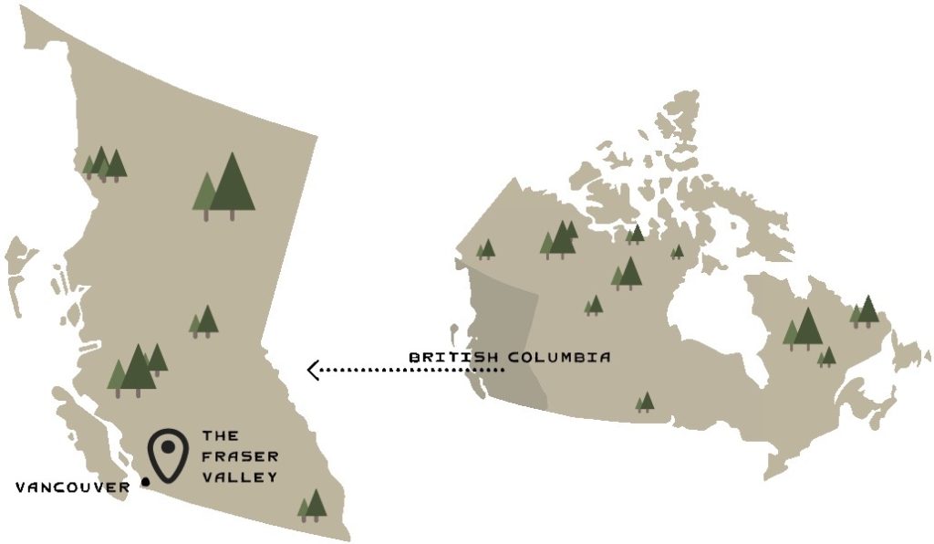
Vancouver International Airport is approximately one hour west of the Fraser Valley by car, with service from most major domestic and international airlines.
Bellingham International Airport in Bellingham, Washington is also located over the US-Canada border one hour to the south of the Fraser Valley by car, and approximately a 25 minute drive from the Peace Arch Border Crossing.
The Fraser Valley Express
From Vancouver take the Millenium Line SkyTrain to Lougheed Town Centre Station in Burnaby. From there, transfer to the Fraser Valley Express (# 66 FVX) which runs to the Carvolth bus exchange in Langley Township, through Abbotsford, and into Downtown Chilliwack. Check FVX schedule for details on stops and bus times.
The West Coast Express
The West Coast Express is a rail service that travels between Waterfront Station in Downtown Vancouver and Mission City on weekdays during morning and evening rush hours. Check schedule for details.
Vancouver to Fort Langley
TransLink also connects Vancouver to Fort Langley. Take the Expo Line SkyTrain to Lougheed Town Centre in Burnaby. Transfer to the 555 or 562 Bus. Check the schedule for travel times and stop locations.
From the East
Depending on your origin and other variables, such as construction, your exact route may vary. However, from Kamloops onwards the most common route into the Fraser Valley will be via BC-5 through Merritt and into Hope (the Yellowhead Highway, also known as the Coquihalla Highway from Kamloops to Hope). The Fraser Valley can also be accessed via BC-3 via the Okanagan or TC-1 via the Fraser Canyon.
From Vancouver
Depending on your destination within the Fraser Valley, car travel takes approximately 60 to 90 minutes from Downtown Vancouver. From where you are staying in the city, head east on the Trans-Canada Highway. The Fraser Valley can also be accessed via BC-99, or BC-17.
From Seattle
The Fraser Valley is located 3 hours north of Seattle. From downtown Seattle, merge onto Interstate 5 northbound toward Vancouver. At Bellingham, take exit 256A-256B for the Aldergrove-Bellingham Highway/ BC-13. This road will take you to the USA/ Canada border crossing and into the Fraser Valley. Don’t forget your passport!
There are local transit options throughout the Fraser Valley, and you can plan your trips through BC Transit. Schedules and stop information available on the website.
Central Valley Taxi (Abbotsford and Mission)
Cheam Taxi (Harrison and Chilliwack)
Pacific Cabs (Langley)
Uber and Lyft is available throughout most of the Fraser Valley. Check the app for service details.
Accessing the mountains often requires a vehicle or shuttle bus. Before selecting a rental vehicle, make sure to look up information about road conditions leading up to your destinations to find out if you’ll need a ride that has more clearance; comes with winter tires and/or chains; and can handle rocky, rugged terrain. Also consider whether you will need a rack or extra trunk space for your gear.
Be aware that there is a Variable Speed Limit System (VSLS) on Highway 1 between Abbotsford and Chilliwack. Speed limit notifications are posted on a series of signs along the highway. If you have not encountered this before, you can find more information about the VSLS on the BC Ministry of Transportation and Infrastructure’s website here.
Winter tires are required along many Fraser Valley roads between October 1 and April 30 each year. Some areas also require chains. Find maps and more details here.
Visit our Fraser Valley community pages to find more resources to get you rolling.
Head to our Travel Tips page to find need-to-know info about exploring the safely in the valley!